It’s official: drones are taking over the world. Or at least, they’re taking over all the cool jobs. We’ve already seen them delivering packages, inspecting bridges, and even herding sheep. And now, it seems they’re headed for the mines.
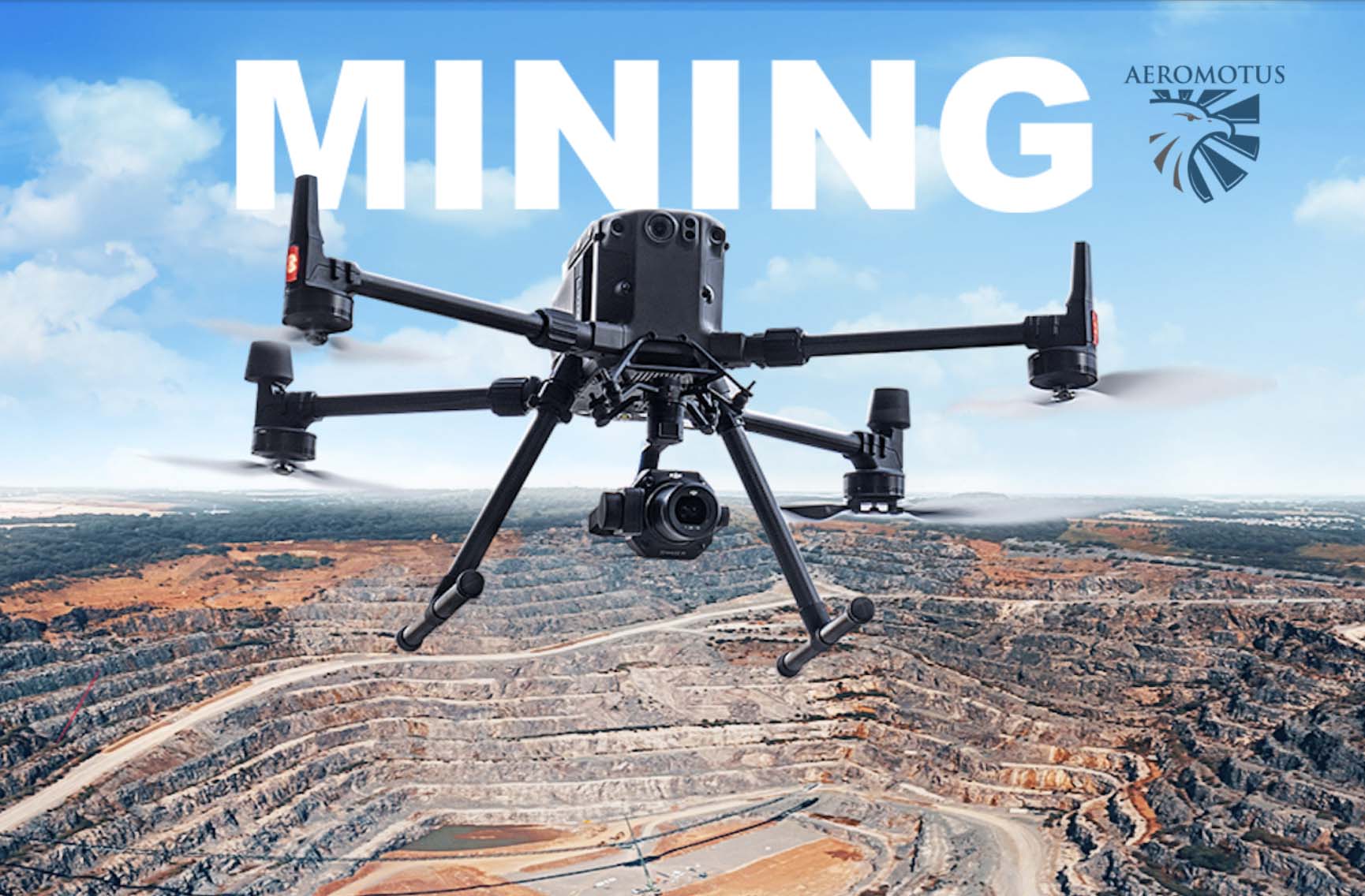
That’s right: drones are being used to help with mining operations. They can map out mines, identify areas of mineral deposits, and even calculate the volumes of embankments and excavations, measurement of quarry sides. In other words, they’re making mining safer, more efficient, and more sustainable.
Measure stockpile, pit, & blast volumes in a few clicks. Never walk a pile again. Drone surveying takes a few hours and your data is ready to access from your PC in 24 hours. DJI Terra easy-to-navigate interface lets you track production without pausing operations.
What can drones do for mining?
Drones are becoming an essential tool for exploration and mapping in the mining sector. With the help of drones, miners can survey potential sites from a safe distance, organizations can keep track of equipment and personnel, and communities can monitor environmental impact.
They can be used to survey large areas of land in a short period of time, helping to identify potential mineral deposits using a magnetometer and magnetometric survey.
In addition, drones can be used to inspect mine shafts and other difficult-to-reach areas, helping to ensure safety and reduce downtime. With their many potential applications, it’s no wonder that drones are becoming an essential part of the mining industry.
Using drones for mining surveillance
Drones can cover more ground in less time and with greater accuracy than traditional surveying methods. In other words, drones provide a bird’s-eye view that is invaluable to the mining industry. This helps to improve the overall efficiency of large mine site and quarry management. Drones also support better coordination among teams onsite and internationally, offering dynamic oversight of all operations.
Drones have a lot of applications in the mining industry. One of the most common uses for drones in mining is surveying. A survey drone is equipped with a downward-facing RGB camera that captures images of a site from different vantage points. These images can be used to create geo-referenced 3D maps, contour lines, digital terrain models, or digital surface models of the mining site.
Mining operators can also use drones to easily extract the precise volume of stockpiles or areas to be excavated. Advanced mining software can also generate industry-specific data, such as safety berm heights, crests and toes, road boundaries, widths, crests, slope, length, and elevation change.
Stockpile management using drones
The stockpiles at the gravel pit are always changing. New gravel is being brought in and old gravel is being taken away. The team responsible for managing the stockpile needs to be able to accurately estimate the volume of the stockpile, so they can make sure they have enough gravel to meet customer demand. But it’s not easy to do this.
The stockpile is irregular in shape and full of craters, making it hard to get a precise measurement using traditional methods like GNSS surveying. These methods are also slow and expensive, which means the team can’t do frequent surveys. And it can be dangerous for the surveyors, who have to climb up and down the piles of gravel or work in the middle of moving machinery. But accurate measurements are essential for effective stockpile management, so the drones use offers new and efficient ways to get the job done.
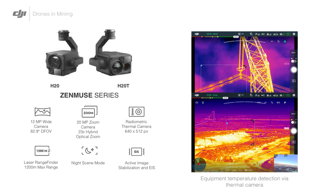
DJI H20T
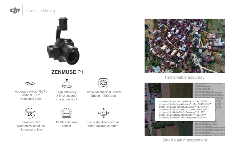
DJI P1
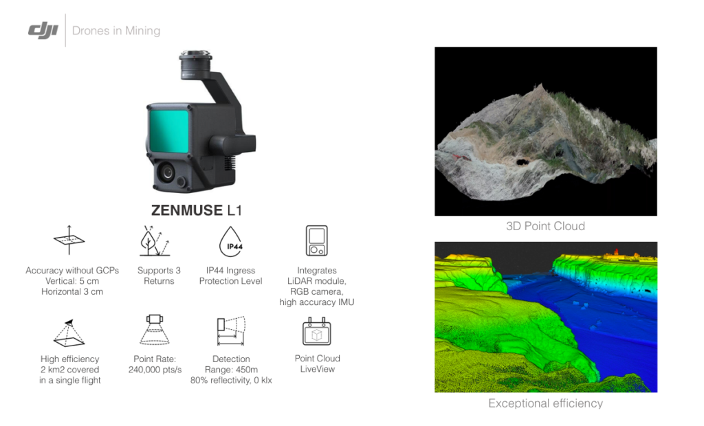
DJI L1

DJI H20T

DJI P1

DJI L1

DJI H20T
Mine and quarry monitoring using digital modeling with drones
In the past, mine managers had to rely on ground-level surveys to get an accurate picture of the site. This was a time-consuming and expensive process. However, with the advent of drone technology, managers can now produce accurate 3D models of the site. This allows them to more efficiently design and manage operations while collaborating across teams.
With an accurate site model, managers can assess the volume of material that must be extracted or moved according to plans or legal standards. In addition, they can identify areas where there is potential for erosion or where new plant life is struggling to take root. As a result, drone technology is providing a valuable tool for mine management and operation planning.
Surface models for blasting using drones
As any miner knows, drilling and blasting are essential for extracting minerals from the earth. However, these activities can also have a significant impact on the surrounding environment. In order to minimize this damage, it is important to assess the area before and after drilling or blasting.
By using drones, you can produce cost-effective and accessible 3D reconstructions and surface models. These models help accurately analyze the area to be drilled and calculate the volume to be extracted post blasting. This data allows you to better manage resources such as the number of trucks needed.
A comparison against surveys taken before and after the blasting will allow volumes to be calculated more accurately. This improves planning for future blasts, cutting the cost of explosives, time on site and drilling.
Getting started with using drones in your mining operations
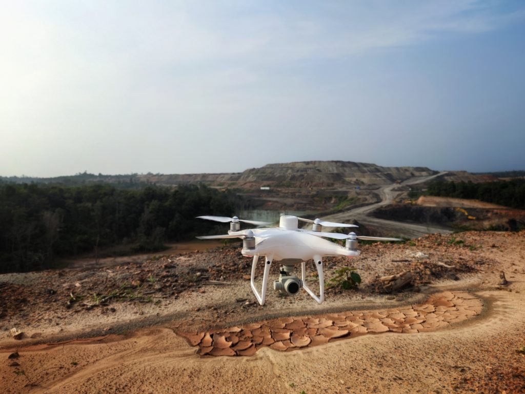
Drones are becoming an increasingly popular tool for mining companies, offering a cost-effective and safe way to collect data and perform surveys of large open pit mines. But before you can start using drones in your mining operations, there are a few things you need to take care of first.
Firstly, you’ll need to make sure you have the right hardware – there’s no point in trying to get started with a cheap toy drone, since it will not meet the needs of any serious operation.
Secondly, you’ll need the right software – there are a number of great options out there, but make sure you pick one that is easy to use and set up.
Lastly, if you’re operating in certain countries, you may need to apply for licenses – in the USA, for example, you’ll need to get a Certificate of Waiver or Authorization from the FAA. Here’s more guidance to get you started.
What kind of drone do you need for your mining site?
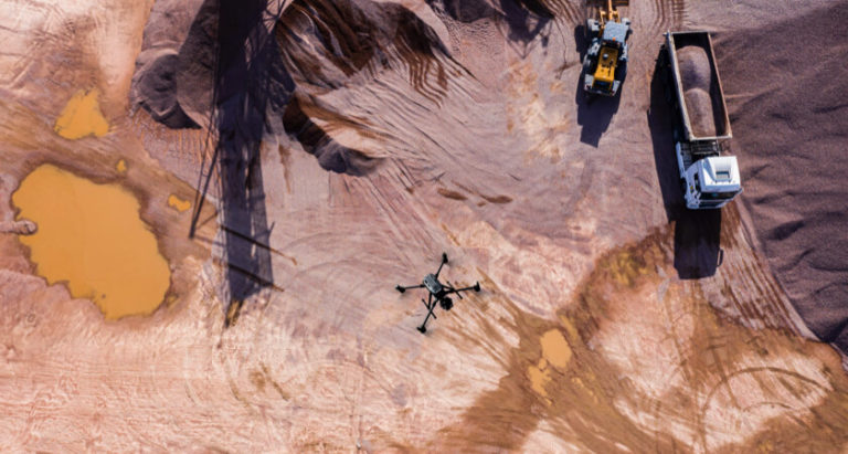
If you’re trying to decide what kind of unmanned aerial vehicle (UAV) to buy for your farm, there are a few things to consider. First, think about the size of your site. If it’s less than 200 hectares (about 500 acres), you can probably get away with a multicopter.
Of course, cost is also a factor. Multicopters are mass produced and relatively cheap, while fixed-wing UAVs are still made in limited quantities, meaning they’re significantly more expensive. finally, think about where you’ll be flying your UAV.
If you’re operating in a restricted area or a busy place near moving equipment, you may not be able to use a fixed-wing aircraft due to their weight and the need for a vacant “runway” strip of land. You also need to consider things like maintenance and repair costs.
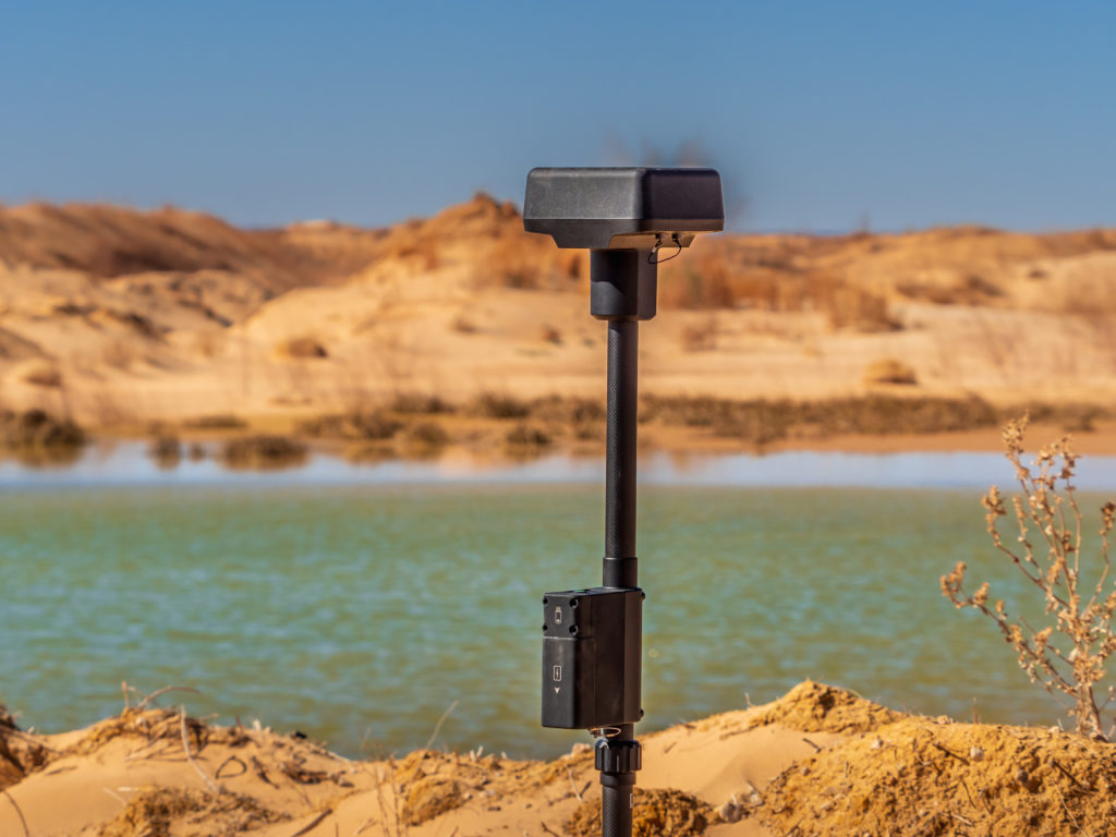
Getting uniform, survey-grade accuracy across your site has never been easier than with DJI MATRICE 300 +DJI P1. The drone’s real-time kinematics (RTK) process records GPS information and geotags images as they’re taken. To determine the drone’s location accurately, a ground station transmits raw GPS data to the drone, which it combines with its own data.
CONTACT US
-
Our office is located in one minute walk from the Emirates Towers Metro Station
1102, Al Moosa Tower 1, Sheikh Zayed Road, Dubai, UAE
-
Telephone: +97143512929
- E-mail: sale@aeromotus.com
- WhatsApp: +971 56 218 8408
Conclusion: Drones are becoming commonplace in mining—and affordable
Drones are increasingly being used in various industries, and mining is no exception. In the past, drones were largely seen as expensive toys for tech-savvy early adopters. However, technological advances have made them more affordable and accessible.
If you’re looking for a fast, affordable way to survey your worksite, drones are the way to go. With drones, you can get high-resolution, up-to-date information on your site’s progress and productivity, so you can produce quality work and obtain complete visibility.
While they may seem like a luxury item, drones have become no more commonplace than a GPS rover but just as vital in recent years. Thanks to their versatility and flexibility, drones can complete various tasks that would otherwise be impossible or impractical.

